Translate

Tuesday, June 28, 2016

Navassa Island Geographic Flag


The Navassa Island Geographic Flag is a tribar of white, purple, and blue.  The colors are coded to numbers based upon the rainbow.  The central star represents the Latitude of 18 Degrees North.  See the Flag Key below to make sense of the number to color symbolism.

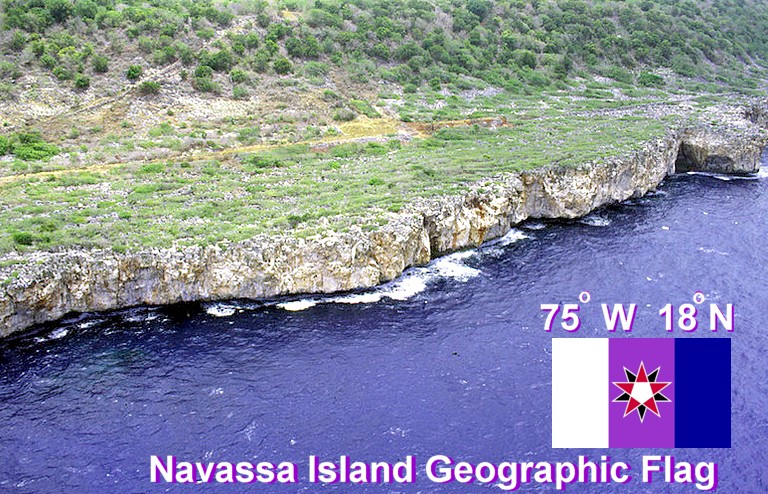
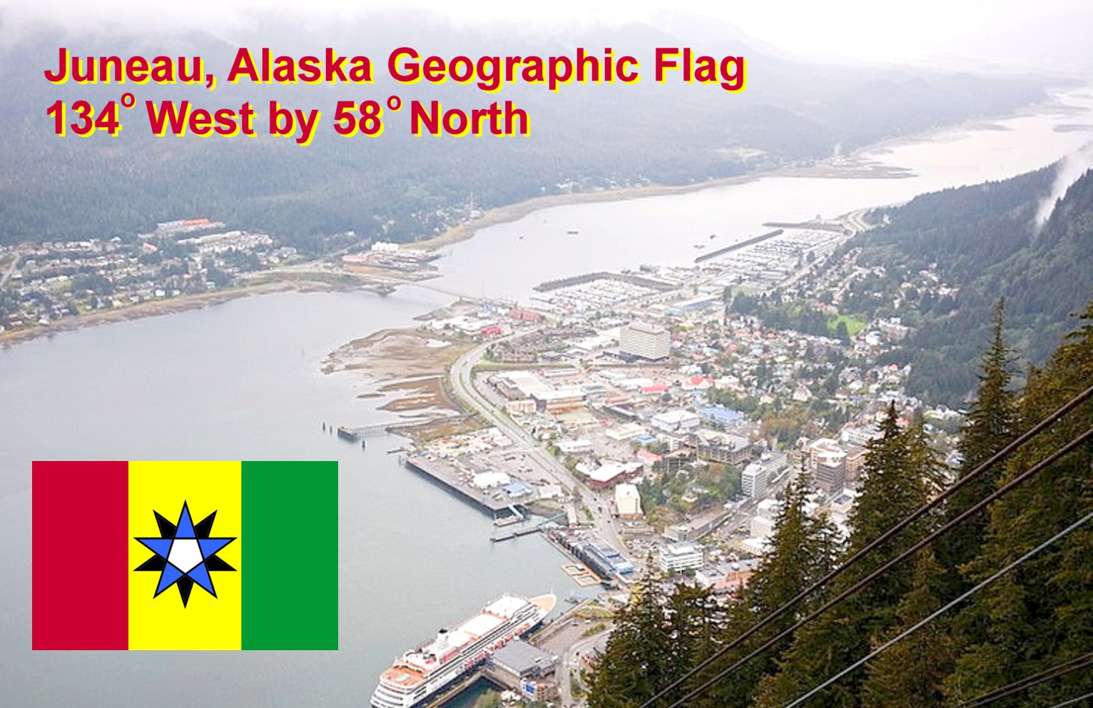
Note this is an apolitical, scientific, objective flag that any nation can fly.  This makes these flags useful in disputed areas.

----------
Image Credit: Wikipedia
https://en.wikipedia.org/wiki/Navassa_Island#/media/File:NavassaCoastAerialUSGS.jpg

Geographic Flag for Juneau, Alaska


The Geographic Flag of Juneau, Alaska reveals its Longitude at 134 Degrees West.  This is indicated by the tribar of red, yellow, and green.  With these types of flags, colors are coded to numbers.  In this case 1, 3, 4, equals 134, which is the Longitude that Juneau sits on.  The central white pentagon also signals that this is in the Western Hemisphere.

The two stars tell the Latitude: 58 Degrees North.  Since the dominant star is pointing up, it is a Northern Parallel.  The code of color to number is based upon the order of the rainbow: red = 1, yellow = 3 and green = 4.

----------
Image Credit: Wikipedia 
https://en.wikipedia.org/wiki/Juneau,_Alaska#/media/File:Downtown_Juneau_and_Douglas_Island.jpg

Geographic Denver, Colorado Flag


The Denver, Colorado Geographic flag is a tribar of red, white, and green.  The colours of this flag are coded to numbers which show its Latitude and Longitude.  As for the Longitude: red, white, and green code for one, zero, and for- indicating Longitude of 104 Degrees West.  Also the central white pentagon indicates this is a Western line of Latitude.

The stars of this flag reveal the Latitude: 39 Degrees North.  Yellow is coded to three, while pink is coded to nine.  Thus we have 39 Degrees North.  Since the dominant star is pointing up, this indicates a Northern Parallel.
 
-----
 Image Credit: https://www.google.com/url?sa=i&rct=j&q=&esrc=s&source=images&cd=&ved=0ahUKEwjsuv6vssvNAhVKVD4KHQMaC1QQjhwIBQ&url=http%3A%2F%2Fwww.keyword-suggestions.com%2FZGVudmVyIHNreWxpbmU%2F&psig=AFQjCNHHPlcaP-DzlCHvpAPKXfNUD_H5nA&ust=1467226361267792&cad=rjt


Geographic Flag for Lubbock, Texas


The Geographic Flag for Lubbock, Texas is a tribar of red, white, and red.  Note that colors are coded to numbers.  And the order is based upon a rainbow: red is coded to 1, yellow is coded to 3, and white is coded to zero. 

The star in the middle represents the latitude: 33 Degrees North.  Since both stars are yellow it makes the number 33.  Also the dominant front star is pointing upwards, and this indicates the Northern Hemisphere.  In addition the central white pentagon indicates a Western line of Longitude.


----
Photo Credit: Wikipedia
https://en.wikipedia.org/wiki/Lubbock,_Texas#/media/File:LubbockSkyline2013.jpg

Geographic Portland, Oregon Flag


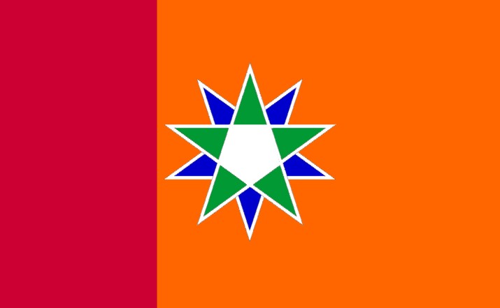
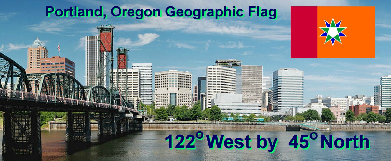
The Geographic Portland, Oregon flag has field of red and orange.  These colors relate to lines of longitude.  In these types of objective and truly scientific flags, colors are coded to numbers.  The order of color to number is based upon the official order of the rainbow. 

Red is coded 1, since it is the first color of the rainbow.  Orange is coded to 2, as it is the second color. Usually Geographic flags of this nature are tribars.  However Portland, Oregon lies on the 122th Western Meridian, thus it gets double dose of orange -forming a block. 

In the center the two five pointed stars reveal Portland's Longitude, which is 45 Degrees North.  Remember that green is coded to 4, since it the fourth color of the rainbow.  And that blue is coded to 5, since it is the fifth color of the rainbow.  Thus when read the stars show us 45 Degrees North.  As the dominant green star is pointing upwards, this indicates a Northern Parallel. 

Note that the white pentagon in the center relates to hemisphere.  Since it is white, we know it is a Western Meridian.  Otherwise a yellow pentagon indicates an Eastern Meridian.  Finally this is a vexillologically "GOOD FLAG" and coincidentally happens to conserve the main colors of the official Portland, Oregon City Flag - green and blue.


----------
Image Credit: Wikipedia
https://upload.wikimedia.org/wikipedia/commons/1/1a/PDX%2C_Oregon_collage.png

Hans Island Flag


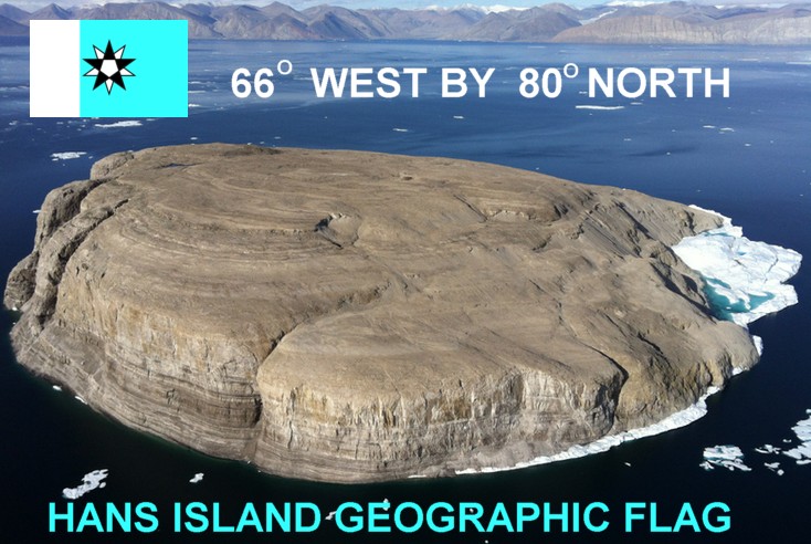
The scientific, vexillologically speaking, apolitical, "GOOD FLAG" Hans Island flag reads: 66 Degrees West by 80 Degrees. See the Flag Key below.


---
Image Credit: https://en.wikipedia.org/wiki/Hans_Island#/media/File:HansIsland.png

Willis Island Flag


Willis Island is one of the few inhabited islands of the Great Barrier Reef.  Note that this reef does indeed have habitable isles that people can live upon.  This Geographic flag reveals this Willis Island's Latitude and Longitude at: 149 Degrees East by 16 Degrees South.

The red, green, pink tribar colours are coded to numbers, based upon the order of the rainbow.  Red is 1, green is 4, and pink is 9; thus 149 Degrees East.  Also the central yellow pentagon indicates that this is in the Eastern Hemisphere. 

As for Latitude, the red and indigo stars read as 16 Degrees South.  Since the dominant red star is pointing downwards, we know it is a Southern Parallel. 


----------
Image Credit: Wikipedia
https://en.wikipedia.org/wiki/Willis_Island_(Coral_Sea)#/media/File:Willis_Island.JPG