
In 1763 a proclamation was made by the Royal Government with the King's approval. It defined the borders of Quebec, East Florida, West Florida, and Grenada in the Caribbean. This 1763 proclamation also defined the reward for colonists on how much land they were entitled. The higher your rank, the more land your were given. Privates got 50 acres while field officers got 100x the amount at 5000 acres. This document would later influence Native American policies with the United States and Canada long after the 1776. However, no line was actually declared. Rather the borders of the Native Tribes and Nations were spelled out, which became known as the Indian Reserve.
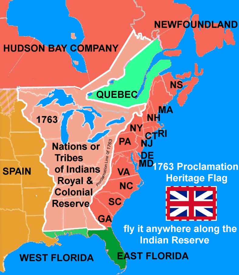
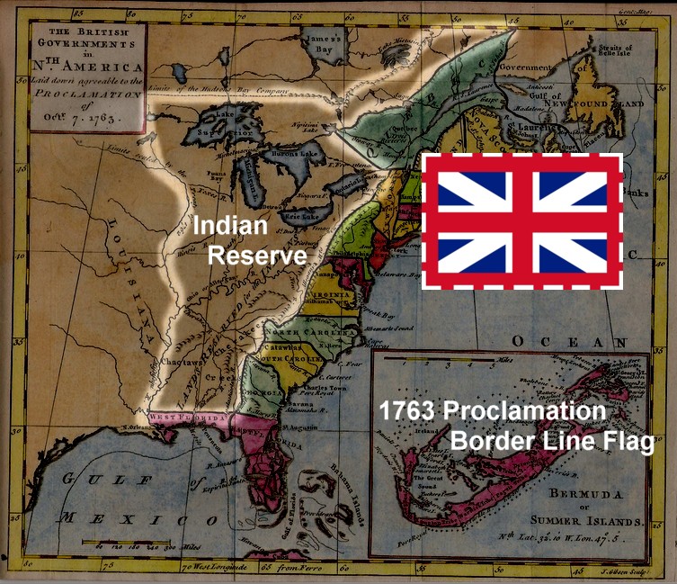 Most 1763 Proclamation Line maps show the line extending from St. Mary River in Georgia to the Bay of Chaleur between Quebec and New Brunswick. But this is a little off, since Quebec became a colony within British North America. Also, the northern border of West Florida was an 'off limits' line.
Consequently, this flag can be flown (going counter clockwise) anywhere along the borders of the Indian Reserve as defined in the 1763 Proclamation as it usually defined from the St. Mary's River between Georgia and Florida to middle of New York until it hits the 45º North; the cutting into newly defined area of Quebec to Labrador to along the old border of the Hudson Bay Company, to lake of the Woods, down the Mississippi River across the old border to West Florida back to St. Mary's River.
Read the 1763 Proclamation Here
http://www.ushistory.org/us/9a.asp
Map of Proclamation 1763 - Issued in 1763
http://www.mapsofpa.com/18thcentury/1763gentmag.jpg
Music Credit: (direct)
https://www.bensound.com/index.php?route=product/search&search=summer&sort=relevance&order=DESC
(main webpage!)
https://www.bensound.com
No comments:
Post a Comment